


Voting District 10, Humboldt County, Nevada
About
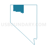
Outline

Summary
| Unique Area Identifier | 615342 |
| Name | Voting District 10 |
| County | Humboldt County |
| State | Nevada |
| Area (square miles) | 1,310.35 |
| Land Area (square miles) | 1,310.00 |
| Water Area (square miles) | 0.35 |
| % of Land Area | 99.97 |
| % of Water Area | 0.03 |
| Latitude of the Internal Point | 41.87459180 |
| Longtitude of the Internal Point | -117.55816960 |
Maps


Graphs
Select a template below for downloading or customizing gragh for Voting District 10, Humboldt County, Nevada


Neighbors
Neighoring Voting District (by Name) Neighboring Voting District on the Map
- Voting District 11, Humboldt County, NV
- Voting District 12, Humboldt County, NV
- Precinct 28, Elko County, NV
- Riddle 11 Voting District, Owyhee County, ID
Top 10 Neighboring County Subdivision (by Population) Neighboring County Subdivision on the Map
- Grand View CCD, Owyhee County, ID (1,294)
- Mountain City CCD, Elko County, NV (1,245)
- McDermitt CCD, Humboldt County, NV (1,099)
- Jordan Valley CCD, Malheur County, OR (685)
- Diamond CCD, Harney County, OR (673)
- Summit Lake CCD, Humboldt County, NV (318)
Top 10 Neighboring Place (by Population) Neighboring Place on the Map
Top 10 Neighboring Elementary School District (by Population) Neighboring Elementary School District on the Map
Top 10 Neighboring Secondary School District (by Population) Neighboring Secondary School District on the Map
Top 10 Neighboring Unified School District (by Population) Neighboring Unified School District on the Map
- Elko County School District, NV (48,818)
- Humboldt County School District, NV (16,528)
- McDermitt School District 51, OR (102)
- Pleasant Valley Elementary School District 364, ID (98)
Top 10 Neighboring State Legislative District Lower Chamber (by Population) Neighboring State Legislative District Lower Chamber on the Map
- State House District 60, OR (55,458)
- Assembly District 33, NV (51,407)
- State House District 23, ID (45,710)
Top 10 Neighboring State Legislative District Upper Chamber (by Population) Neighboring State Legislative District Upper Chamber on the Map
- State Senate District 30, OR (115,913)
- Rural Nevada Senatorial District, NV (97,335)
- State Senate District 23, ID (45,710)
Top 10 Neighboring 111th Congressional District (by Population) Neighboring 111th Congressional District on the Map
- Congressional District 1, ID (841,930)
- Congressional District 2, NV (836,562)
- Congressional District 2, OR (769,987)
Top 10 Neighboring Census Tract (by Population) Neighboring Census Tract on the Map
- Census Tract 105, Humboldt County, NV (6,116)
- Census Tract 9709, Malheur County, OR (5,899)
- Census Tract 9502, Owyhee County, ID (3,913)
- Census Tract 9517, Elko County, NV (2,669)
- Census Tract 9602, Harney County, OR (2,141)
- Census Tract 9400, Malheur County, OR (0)